top of page

Tsukuba Challenge


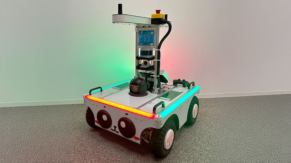
Every year, we participate in the "Tsukuba Challenge" held in Tsukuba City, Ibaraki Prefecture, Japan, with a self-propelled outdoor drone developed by the Chief Scientist Office.

​What is the
“Tsukuba Challenge”

​「つくばチャレンジ」とは


"Tsukuba Challenge" is a technical challenge held every year since 2007, in which mobile robots autonomously run in urban areas such as the sidewalk in Tsukuba. The purpose is to advance autonomous driving technology in the real environment (real world) that people usually use. It is an event where researchers and the local community cooperate to challenge advanced technologies and conduct open experiments.

​For more information, please see the "Tsukuba Challenge” official page.
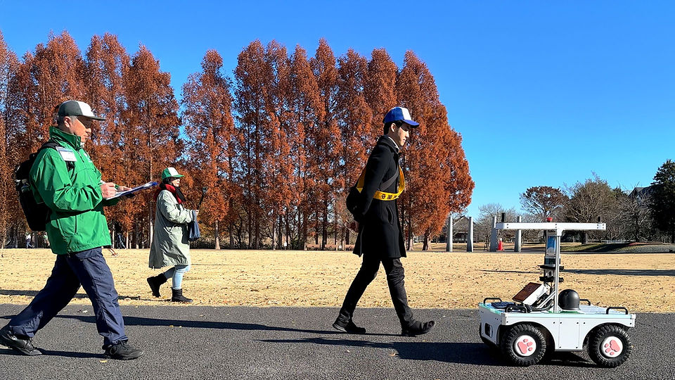
https://tsukubachallenge.jp

Participation from 2019

2019年から参加開始

The Chief Scientist Office has participated since 2019 with a self-propelled outdoor drone developed in our department.

NEDO's outdoor driving demonstration "Rafute"

NEDOの屋外走行実証にも利用した​「Rafute」

“Rafute” is developed based on “Cuboid” with wheels and 3D LiDAR for outdoor use.
We built an "outdoor autonomous driving system" based on ROS + Autoware.

By participating in the “Tsukuba Challenge,” we aim to verify the outdoor driving functionality and interact with other teams to improve the hardware and software further.

"PANDA" robot for outdoor running

屋外走行用ロボット「PANDA」


Since FY2021, we have been developing "PANDA," an outdoor driving robot. We have significantly modified the hardware design to address stability and sensor placement issues discovered through experiments with "Rafute." We designed the robot with a lower center of gravity to travel stably on uneven terrain. We divided it into two modules for the bogie and sensor sections, allowing easy modification of sensor types and placement.

屋外走行用ロボット「PANDA」

We are also developing a high-precision position estimation function by combining 3D point clouds, IMU, and RTK-GNSS, using the high-precision positioning service "ichimill" for RTK-GNSS positioning.

屋外走行用ロボット「PANDA」


In 2022, in addition to the waypoint tracking function of Autoware, we plan to introduce obstacle avoidance operation to achieve long-distance travel. We have also reassembled the frame and prototyped a waterproof exterior.

3D Mapping


The image was taken at 4x speed from start to finish on the map.
The map was created by projecting the color information of the fisheye camera onto a 3D Lidar (velodyne) point cloud.

Tsukuba Challenge 2023

つくばチャレンジ2023


We have replaced the previous RTAB MAP with LIO-SAM to create a more accurate 3D map. In addition, we aim for stable long-distance navigation by integrating 3D point cloud data and GNSS information.

つくばチャレンジ2023

With the robot's improved stability in driving, we tuned the speed and acceleration, and we achieved smoother and more seamless driving by enhancing the speed of calculating obstacle avoidance routes.
We implemented the integration of GNSS and LiDAR, which improved self-position estimation accuracy for long-distance driving.

We had to retire after surpassing the turnaround point, 1.3 kilometers into the race. The robot lacked the capability to move backward when avoiding obstacles, therefore, the robot stopped moving when it came too close to an obstacle.

bottom of page